|
All 5 books, Edward Tufte paperback $180
All 5 clothbound books, autographed by ET $280
Visual Display of Quantitative Information
Envisioning Information
Visual Explanations
Beautiful Evidence
Seeing With Fresh Eyes
catalog + shopping cart
|
Edward Tufte e-books Immediate download to any computer: Visual and Statistical Thinking $5
The Cognitive Style of Powerpoint $5
Seeing Around + Feynman Diagrams $5
Data Analysis for Politics and Policy $9
catalog + shopping cart
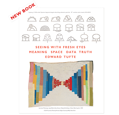
New ET Book
Seeing with Fresh Eyes:
catalog + shopping cart
Meaning, Space, Data, Truth |
Analyzing/Presenting Data/Information All 5 books + 4-hour ET online video course, keyed to the 5 books. |
Here is a graphic that I propose be posted to the Ask ET forum. I came across it in the June 2000 issue of National Geographic. It displays the heights of buildings in a city (New York) by color coded scaled replicas of each building. Red is used for the tallest, then orange, yellow, etc. thru the spectrum, with only green (used to represent ground level) being out of sequence. I like this graphic as the logical use of colors on the three dimensional map is easy to comprehend and intuitiviely communicates a lot of information to the eye. Beyond that, however, once created, this graphic (in the computer) becomes a usable engineering tool to define line of site positions for wireless communications antennaes, as explained in the text that accompanies it.
Once again, the graphic artist is not identified--only the firm.
 |
-- Jim Heimer (email)
|
|||||||||||