|
All 5 books, Edward Tufte paperback $180
All 5 clothbound books, autographed by ET $280
Visual Display of Quantitative Information
Envisioning Information
Visual Explanations
Beautiful Evidence
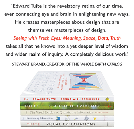
Seeing With Fresh Eyes
catalog + shopping cart
|
Edward Tufte e-books Immediate download to any computer: Visual and Statistical Thinking $5
The Cognitive Style of Powerpoint $5
Seeing Around + Feynman Diagrams $5
Data Analysis for Politics and Policy $9
catalog + shopping cart
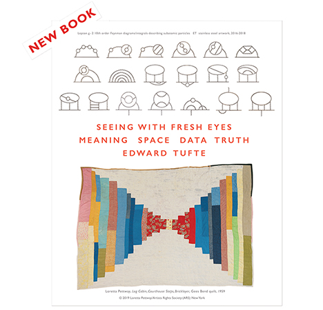
New ET Book
Seeing with Fresh Eyes:
catalog + shopping cart
Meaning, Space, Data, Truth |
Analyzing/Presenting Data/Information All 5 books + 4-hour ET online video course, keyed to the 5 books. |
See this review of Nicholas Crane, Mercator: The Man Who Mapped the Planet for the immense distortions resulting from the achievement of rectilinear rhumb lines in translating the spaceland of Earth to the flatland of paper.
-- Edward Tufte
...to set things right, Arno Peters has produced this atlas, in which the entire earth's surface is shown at the identical scale in HIS eponymous projection:
Not content to redress the injustices of scale, Peters even suggests we do away with the 360-based, Greenwich-centered latitude and longitude graticule in favor of decimal intervals with an origin along the international date line.
-- Matt Frost (email)
Though all cartographers must make choices on scale, placement, etc., we could also step back to "the problem to be solved", as Mr. Tufte so frequently advises.
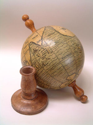
In education, for instance, if the goal is the understanding of continents, geographic knowledge, terrain, political environments, navigation, voyages, etc., why compromise on "acceptable distortion" when globes of an infinite variety are available cheaply!
Where are the classes teaching geography with desk-size globes, instead of book-based maps?
Too bulky? It's easy to envision an inflatable / erasable desk-top globe ... get to class, blow up your globe ... draw on your globe, plot voyages, chart current events, ..., bell rings, you deflate your globe and off to lunch you go!
Michael Round
-- Michael Round (email)
Mercator's projection is good for navigators, but not for measuring areas. Gall's projection (the one used by Peters in his atlas) preserves areas, but severely distorts shapes. All maps of the globe are compromises, at best, as cartographers have long known (see, e.g. J. Campbell, Map Use and Analysis). Michael Round's answer is the best: if you want to see what the globe looks like, look at a globe. Small, inflatable globes are available-- I've bought them for my children. Natural history or science museum gift shops often have them.
-- Gregory C. Mayer (email)
When I read this article this am I was reminded of this thread:
http://www.eurekalert.org/pub_releases/2003-02/wuso-mtb021203.php
-- Gene Prescott (email)
Bukmeister Fuller had a proposal for a world map that preserved area: http://www.wnet.org/bucky/dymap.html
It divides the globe into a geodesic dome and then lays it out flat.
A site describes it this way:
Unique Features of The Fuller Projection:
* A map of the Earth which presents geographic information in a single, comprehensive picture without breaks in any of the continental contours, or any visible distortion of the relative shapes or sizes of the land masses.
-- Richard C Haven (email)
On a recent overseas trip I found it hard, without a globe in hand, to explain why our flight path was following such an apparently indirect route on the in-cabin displays. It was much easier to explain with a globe and piece of string when I got home.
-- John Morse (email)
Speaking of globes... You may want to look at the historic reproductions made by Greaves & Thomas in the UK. They manufacture wonderful reproductions of important historic globes. Their web site is listed below. Take note of the design of Holbein's small terrestrial globe mounted on a small wooden handle for easy viewing (see also Magellen's 1522 globe). Ideal for seeing how world geography was being conceptualized in the 16th and 17th centuries.
http://myweb.tiscali.co.uk/greavesandthomas/index2.html
 |
 |
-- Daniel Meatte (email)
The British Library has an online exhibit called "Turning The Pages" - http://www.bl.uk/onlinegallery/ttp/ttpbooks.html - showing specially scanned images of some of its rare books. One of the books available is Mercator's 1570s atlas of Europe.
-joel
-- Joel Stein (email)
Polyhedra and more
Polyhedral representations of Earth have interested me since college.
Here is an article that describes ways to overcome distortion which result from trying to resolve a sphere onto Flatland.
The previous link is a section of Carlos A. Furuti's splendid and exhaustive webpage on cartographic representations.
Here is a handy site index with hyperlinks. There is much to recommend.
-- Jon Gross (email)
|
||||||